
I have ongoing interests in a range of research topics in Alaska and New York. Please see Publications for finished papers/reports and contact me for reprints or further information.
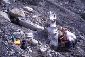
Glacier and tree-ring studies in Alaska:
- Reconstructing valley glacier histories as a proxy record of late Holocene climate change
- Building long tree-ring chronologies for dating earthquakes and glacier fluctuations
- Using paleorecords to understand tidewater glacier behavior over decades to millennia
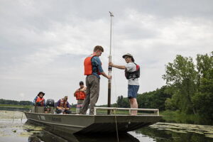
Landscape studies in New York:
- Evidence (or lack thereof) for local valley glaciers in the Adirondack Mountains during the late glacial period
- Deglacial history of the Finger Lakes region based on lidar-derived geospatial imagery
- Migrating river channels and groundwater-induced flooding in central New York
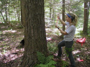
Old trees and forests in New York:
- Dating historical buildings in Willsboro and elsewhere in the Adirondacks
- Extending living tree chronologies back in time for paleohydrologic reconstructions
- Locating old forest remnants for their scientific and aesthetic values
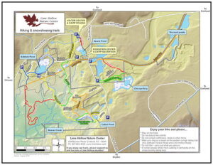
Geospatial imagery for teaching and recreation:
- Smartphone Digital Elevation Model (DEM) and hillshade images with real-time location for teaching geomorphology and landforms in the field
- Smartphone trail maps for Lime Hollow Nature Center with real-time location on lidar-derived geospatial imagery
Data sets:
Completed tree-ring chronologies are publicly available at the International Tree-Ring Data Bank at NOAA [link]
Trail maps for Lime Hollow are publicly available in the map store of the free Avenza Maps app [link]